Daeyoung Drone Solution Co., Ltd. will become a company that communicates with consumers from a customer's point of view and provides customized solutions, not just selling drones.
Daeyoung Drone Solution Co., Ltd. uses a variety of payloads to provide a variety of industrial drones to suit various expertise.
In the future, the drone market will grow together with the growth of industrial drones.
The drone market is developing in various fields, including construction, surveying, agriculture, forestry, cultural properties, safety diagnosis, and transportation.
Daeyoung Drone Solution Co., Ltd. is a customized drone solution and will try to become a leader in the drone market with you.
01. Construction/Surveys
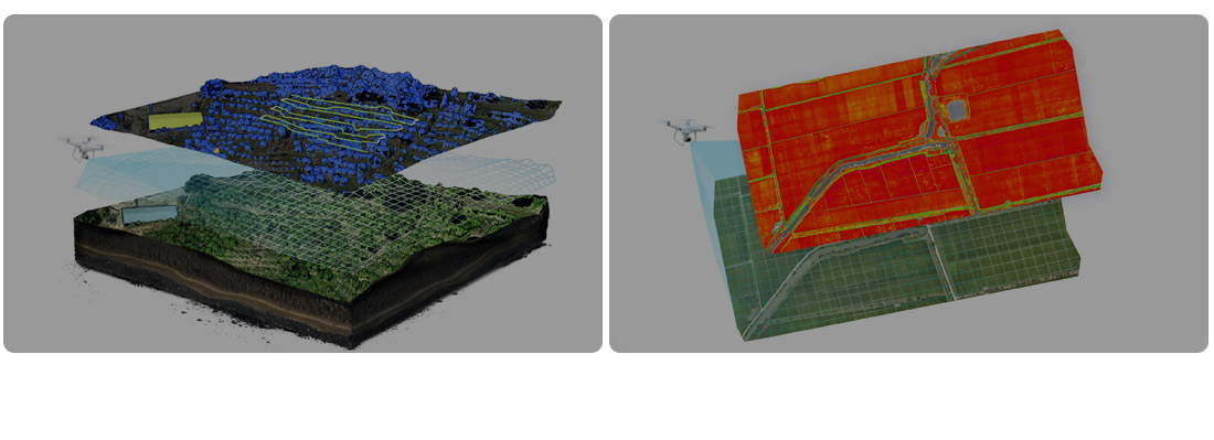
It is mainly aimed at producing digital topographic maps such as design topographic status maps, construction scale status maps, earthwork calculation, completion survey, and map production sales. It is being introduced to various construction sites such as apartments, houses, architecture, and civil engineering through drones, and the overall situation of the construction site can be managed in real time through cloud-based platform services.

02. Agriculture/Forest
Recently, the domestic agricultural environment has been struggling with various disasters due to the aging of the agricultural population, weather changes, and market opening due to the FTA. In order to solve these problems and develop into sustainable agriculture, innovation into precision agriculture fused with advanced science and technology is required.
Precision agriculture is a production method that maximizes production while minimizing input resources such as fertilizer, water, and labor using various ICT technologies. In order to revitalize precision agriculture, various technologies are applied and are currently being used in the agricultural/forest field through drones.
In the field of drone agriculture, crop mapping, crop pest damage investigation, water shortage status, and irrigation facilities are used.
In the forest sector, it is also used for insect damage, forest fire damage, and tree species investigation.
03. Cultural Properties
Drones are also used to identify the status of cultural properties in places that are inaccessible to humans and to identify damage to cultural properties in the event of a disaster such as an earthquake or landslide. In addition, cultural properties can be photographed with drones and preserved/restored/managed through 3D modeling through sauna processing, and inspected. As such, we can actively engage in cutting-edge technologies that meet the 4th industrial era to lead scientific and efficient cultural property safety management at the preventive stage before the value of cultural properties is damaged.

04. Safety diagnosis
Drone structure safety diagnosis is excellent in safety and economic feasibility without being directly exposed to dangerous situations such as bridges, transmission towers, and dams that are difficult to access. It has the advantage of being able to make a clear safety diagnosis of the structure by accurately and closely measuring and photographing the area in question and analyzing it through post-processing.
